This just in from Dallas:
San Diego isn't the only place burning; I suspect that Baja has as much land burning as California, if not more. The hills on both sides of the valley on the way in to La Bocana are burning or have burned. We saw at least one of the houses burned to the ground, and most disturbing of all,many of the old Oak trees are gone.
Although we feel safe where we are located, we are watching the advance of the fire. Perhaps, from our prospective, the smoke and falling ash are the worst at this time. We have to keep the house closed up.
Update 10/28/07: Dallas reported that the fires are mostly out and stayed about 2 miles from the coast (east of the dump).
Wednesday, October 24, 2007
Tuesday, October 23, 2007
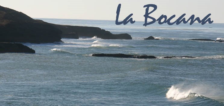
Fires - So Cal and Baja
The Santa Ana winds and recent drought have joined forces to create terrible fires across Southern California and Baja California.
Our best wishes to all who live in the fire areas and who have been evacuated. We hope you, your families, your pets, and your homes are safe.
Dan Sedor, who owns the beautiful house with the octagon, reported that there are fires south of Maneadero. He found this map which shows lots of fire activity, perhaps near the road to La Bocana.
The two blue dots in the south represent La Bocana and the port.
If anyone has any information, please post on the comments section below and share with us.
Stay safe everyone.
Our best wishes to all who live in the fire areas and who have been evacuated. We hope you, your families, your pets, and your homes are safe.
Dan Sedor, who owns the beautiful house with the octagon, reported that there are fires south of Maneadero. He found this map which shows lots of fire activity, perhaps near the road to La Bocana.
The two blue dots in the south represent La Bocana and the port.

If anyone has any information, please post on the comments section below and share with us.
Stay safe everyone.
Saturday, October 06, 2007
Directions to San Ysidro Sentri Lane:
I know people would rather go to the San Ysidro Sentri lane than to the Otay Mesa crossing if it was easy to get there. I found these directions on another website - I have not tried them out myself. The written directions do not have street names. I'll try to find them on my Tijuana map and add them in. If you try these dirctions, let us know how it worked!
Directions:
Because you are dealing with round-abouts, a primmer may be necessary: a right turn is 1/4 of the way around, straight ahead is 1/2 way around and a left is 3/4th of the way around.
I suggest getting off the toll road in Rosarito Beach (Norte) and proceeding north on the Free Road. At the first round about in Tijuana, go three quarters of the way around (you are, in essence, making a left).
Go a block. At the next roundabout, make a right (that's a quarter of the way around). GO ACROSS THE BRIDGE!
At the next round about, go 3/4th of the way around (essentially a left turn).
At the next round about, go 1/2 way around (or straight ahead). Right after you get beyond the roundabout, you'll see a sign straight ahead that says "SENTRI."
I found these maps, too: San Ysidro Sentri lane from the free road:
 And here's one from the toll road:
Directions:
Because you are dealing with round-abouts, a primmer may be necessary: a right turn is 1/4 of the way around, straight ahead is 1/2 way around and a left is 3/4th of the way around.
I suggest getting off the toll road in Rosarito Beach (Norte) and proceeding north on the Free Road. At the first round about in Tijuana, go three quarters of the way around (you are, in essence, making a left).
Go a block. At the next roundabout, make a right (that's a quarter of the way around). GO ACROSS THE BRIDGE!
At the next round about, go 3/4th of the way around (essentially a left turn).
At the next round about, go 1/2 way around (or straight ahead). Right after you get beyond the roundabout, you'll see a sign straight ahead that says "SENTRI."
I found these maps, too: San Ysidro Sentri lane from the free road:
And here's one from the toll road:
Note: the blog editor is not resonsible for anyone who attempts to follow these directions and gets hopelessly lost in Tijuana, adding hours to their journey or inches to their waistline (due to the necessity of buying churros to stave off starvation)
Subscribe to:
Posts (Atom)